This blog is a place to show y'all my road photos and videos... and the other randomness that's me.
Saturday, November 27, 2010
Friday, November 26, 2010
Sunday, October 31, 2010
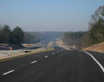
West Fayetteville Parkway - Phase I

West Fayetteville Parkway - Phase I (Video) [HD]
West Fayetteville Parkway - Phase I (Description)
West Fayetteville Parkway - Phase II (Description)
Friday, October 29, 2010
Brightstar Road Connector - Douglasville, Ga.
The Brightstar Road Connector, which connects Rose Avenue (at S.R. 5/Bill Arp Road) and Brightstar Road, was built by the City of Douglasville, at a cost of $2.6 million. The end of the connector enters unincorporated Douglas County, which is under the jurisdiction of the Douglas County Board of Commissioners. The County (Board of Commissioners) wanted the City to install a traffic signal at Brightstar Road and Brightstar Road Connector. The City would've gone through with it, if the County would've gone 50/50; the County declined. So, Douglasville refused to do it; the County shut the road down. Douglasville then shifted traffic into their city limits, to have the road open for commuters.
Click link below to view a video of the road in its current condition.
Brightstar Road Connector [HD]
Click link below to view a video of the road in its current condition.
Brightstar Road Connector [HD]
Sunday, October 10, 2010
Upcoming Roadtrips
This post will concern three roadtrips that I want to get under my belt within the next year: Atlanta to Huntsville; Atlanta to Savannah; and Atlanta to Albany.
Huntsville roadtrip (Click link for map):
This roadtrip's been accomplished!!
The routing that I wish to take will be as follows: I'll take S.R. 6 West from I-285, which is three miles west of Hartsfield-Jackson Atlanta International Airport, in East Point. S.R. 6 West picks up U.S. 278 West in the former city of Lithia Springs, in Douglas County. I'll continue on U.S. 278 through western Georgia and into Gadsden, where I'll jump on Alabama State Route 291 South to Alabama 759 West, which becomes I-759 West. I'll then follow I-759 West to I-59 North to exit 183 (U.S. 278/431). I'll continue to follow 431 North into Huntsville. While in Hunstville, I want to film Memorial Pkwy. (U.S. 231/431), Alabama 255 (Research Park Blvd.), Martin Luther King Jr. Hwy., Bob Wade Lane and I-565/U.S. 72 Alternate, as well as U.S. 72 East up into Tennessee.
Savannah roadtrip (Click link for map):
I want to film all of the Savannah area freeways: Veterans Parkway, Harry Truman Parkway, I-516, U.S. 17/S.R. 404 Spur, and I-16. Also, I'd like to do several street tours: U.S. 80 East/S.R. 22 East from near Thunderbolt to Tybee Island; U.S. 80/S.R. 22 in downtown Savannah to east of downtown; Abercorn Expressway/Street from I-95 to downtown Savannah.
Albany roadtrip (Click link for map):
Lastly, I want to film unbuilt I-175/S.R. 300 from I-75 in Cordele to Albany.; do an Albany street tour; and film the Liberty Expressway, portions of which are U.S. 19/82/S.R. 3/300/520. I got turned around, so I didn't get a chance to film S.R. 300 while in the Albany area, but I will go back one of these days and do it. :-D
Huntsville roadtrip (Click link for map):
This roadtrip's been accomplished!!
Savannah roadtrip (Click link for map):
I want to film all of the Savannah area freeways: Veterans Parkway, Harry Truman Parkway, I-516, U.S. 17/S.R. 404 Spur, and I-16. Also, I'd like to do several street tours: U.S. 80 East/S.R. 22 East from near Thunderbolt to Tybee Island; U.S. 80/S.R. 22 in downtown Savannah to east of downtown; Abercorn Expressway/Street from I-95 to downtown Savannah.
Albany roadtrip (Click link for map):
Lastly, I want to film unbuilt I-175/S.R. 300 from I-75 in Cordele to Albany.
U.S. 411 Connector/Emerson-Cartersville Bypass
Hello, good people. It's Bryant, your friendly neighborhood southern roadgeek-man, again. :-D
Alright, now to the topics at hand: the U.S. 411 Connector and the Emerson-Cartersville bypass. Emerson and Cartersville are both in Bartow County, which is 32 miles or so north of downtown Atlanta. Emerson is in close proximity to Red Top Mountain State Park and Allatoona Lake. U.S. 411/S.R. 20 provide access to Rome and Gadsden through the northern Cartersville city limits. The stretch of S.R. 20 from I-75 to its multiplex with U.S. 41 and U.S. 411 is a very congested point, due many travelers utilizing the U.S. 411/S.R. 20 expressway to reach Rome and Gadsden. There have been talks of building a freeway from I-75 to the current Rome expressway on the northwestside of Cartersville, but that's still on paper, as of now.
Currently, GDOT is building the Emerson-Cartersville bypass, which will become apart of State Route 113. The bypass will utilize Red Top Mountain and Old Alabama roads, along with a new connector, currently under construction.
Current route to Rome from I-75
(courtesy of maps.google.com)
U.S. 411 Connector detail (connectivity improvements)
(courtesy of GDOT, by way of GRG)
Chat About Emerson-Cartersville Bypass
(courtesy of city-data.com)
Red Top Mountain/Old Alabama Roads (current routing)
(courtesy of maps.google.com)
I wasn't a big proponent of Twitter, at first, as I felt that it was pointless. The reason that I felt that way was because I was like, "Why would anyone want an update of frivolous stuff going on in my life?" So, just for the heck of it, I joined; it isn't as bad as I thought that it would be. Since I joined it yesterday, I have 41+ tweets. I wanted "Southern Roadgeek" as my handle, but it wouldn't fit, so I went with "SoRoadgeek."
Check me out on Twitter at: http://www.twitter.com/SoRoadgeek/.
Wednesday, October 6, 2010
Emory Village Roundabout
Hey, y'all. It's me, Bryant, again.
The Emory Village, which is centered around Emory Univeristy just northeast of the Atlanta city limits, is getting another roundabout. There's currently a mini-roundabout, if you will, at the intersection of North Decatur Road and Lullwater Road. The intersection that's getting the roundabout -- North Decatur Road, Oxford Road and Dowman Drive (Emory University's entrance) -- is a five-leg intersection, with each direction on its own separate signal phase. There are also plans to give North Decatur Road a road diet, making North Decatur one lane each direction for through traffic, with a double left turn-only lane, to facilitate left turning traffic.
Just a few things to remember when driving through a roundabout: traffic inside of the circle has right-of-way; pedestrians in the crosswalks do as well. If there's no conflicting traffic, do no stop; keep moving. Additionally, in multi-lane roundabouts, choose your lane position early; do not change lanes inside of a roundabout. Lastly, slow down and pay attention to what's going around you. I know. I know. It's hard with trying to text, talk on a cell phone, read the paper, put on make-up, etc. while driving, but try not to to do these things. :-D
Emory Village New Roundabout
(courtesy of myfoxatlanta.com)
More on Emory Village New Roundabout
(courtesy of emory.edu)
Video on How to Drive Roundabout
(courtesy of YouTube user MORPCSafety)
Saturday, September 25, 2010
Videos Near Georgia 400
Video Description: This video follows Abernathy Road/Perimeter Center (West & East) through the Perimeter Center Business District, which is a major Metro Atlanta edge city, centered around Perimeter Mall. The district is in two of Metro Atlanta's newest cities: Sandy Springs (incorporated December 2005) and Dunwoody (incorporated December 1, 2008)
Dawsonville, Georgia [HD]
Dawsonville, Georgia [HD]
Video Description: This is a real-time video of the small, north Georgia mountain city of Dawsonville (population 619). NASCAR racer Bill Elliott grew up near here, and Bill Goldberg (of WCW/WWE) once lived there, as well.
Photo courtesy of aaroads.com.
Photo courtesy of aaroads.com.
Friday, September 24, 2010
Georgia 400 toll extension

I know that I haven't posted in awhile, but here I am, back again. Today, GSRTA (Georgia State Road and Tollway Authority) voted to extend the tolls on Georgia's only toll road -- State Route 400, which connects the Buckhead community as well as north Fulton County with the north Georgia mountains. Planning for the portion of Georgia 400 between I-285 and its terminus at S.R. 60 (Dahlonega) began in 1954, and was dedicated in 1971. The southern extension between I-85 and I-285 was opened in 1993, with a toll of $0.50 for 2-axle vehicles.
We, as the Georgia taxpayers, were promised that the tolls would be removed from this road when the bonds were paid off, which would've been next summer (2011); however, the tolls will be extended to 2020. When the bonds are paid off next year, SRTA will have over $40 million dollars in their reserves, which could/should go toward building the missing link at the Ga. 400/I-85 interchange. There's no direct connection from I-85 South to Georgia 400 North; nor is there a direct connection from Georgia 400 South to I-85 North. Motorists have to navigate a confusing/congested route: Sidney Marcus Boulevard, Cheshire Bridge/Lenox roads and Buford Highway. Here's a diagram of the preliminary plans on how the interchange could look (CLICK HERE). Also, there's the cost of tearing down the toll plaza, if the tolls were ever gotten rid of. Also, the Ga. 400/I-285 interchange is antiquated and is one of the most dangerous interchanges in the state. Traffic from I-285 East to Georgia 400 North has to merge left to right... with a very short taper (CLICK HERE).
In short, I'm disappointed that our elected officials didn't keep their promise to remove the tolls from 400 when the bonds are to be paid off next year; however, if they utilize all of the monies in their (SRTA's) reserves and those collected until/into 2020 to build that missing link, knock down the toll plaza and revamp the Ga. 400/I-285 interchange, I'm supportive of this decision.
Georgia 400 Tolls Extended Until 2020
(Courtesy of ajc.com)
Monday, April 19, 2010
Interstate 69 (Mississippi)
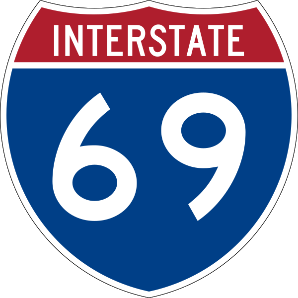
Hey, y'all, this is Bryant again. This post concerns the NAFTA Superhighway: Interstate 69. I-69 will connect Port Huron, Michigan and Point Edward, Ontario with the Texas-Mexican border. Currently, I-69's only contiguous portion is between Port Huron and Indianapolis, Indiana.
Recently, I went on vacation to Harrah*s Tunica, located in Tunica Resorts (formerly Robinsonville), Mississippi. Mississippi's portion of I-69 divergs from I-55 at exit 283 (S.R. 304 West - Tunica) in Hernando, the county seat of DeSoto County. I-69 follows S.R. 304 West for about ten miles until it merges on S.R. 713 South for about five miles, roughly.
The first two videos were filmed 4 July 2009, while the last video was filmed 11 April 2010.
I-69 South/S.R. 304 West
I-69 North/S.R. 304 East
I-69 South/S.R. 713 South [HD]
Thursday, April 15, 2010
Corridor X West

Hey, y'all, it's me again. This post is concerning Future I-22/U.S. 78/Corridor X. Corridor X follows the Future I-22 Corridor from its unfinished end at I-65 in Fultondale, Alabama to Fulton, Missisissippi. Future I-22 will provide Memphis, Tennessee and its suburbs with high-speed access to Atlanta via I-20 in Birmingham.
Corridor X West [HD] (video)
Future I-22/U.S. 78/Corridor X description (AARoads)
Wednesday, April 14, 2010
Roadtrip -- Metro Atlanta to Tunica
Hey y'all,
It's me again. Just got back from Tunica, Mississippi yesterday. While driving out there, I recorded footage for about five videos: U.S. 78 between I-20 and Future I-22; Corridor X West between Bankhead Highway and S.R. 118/Carbon Hill; Corridor X East between Bankhead Highway and Jefferson C.R. 77/Coalburg Road; S.R. 302/Goodman Rd. (between Future I-22/U.S. 78 and I-55); and I-69/S.R. 713 between S.R. 304 and Harrah*s Casino and Hotel. It was an interesting trip, to say the least.
U.S. 78 between I-20 and Future I-22 (VIDEO)
(Jefferson County, Alabama)
Wednesday, March 17, 2010
Red Light Cameras Gone in the City of Atlanta?

Those motorists who received tickets at the intersections operating without a permit from the State may get their money refunded.

Monday, March 15, 2010
Future Interstate 22
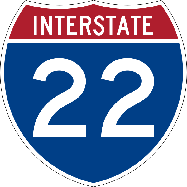
This blogpost will give a brief detail of the Memphis-Birmingham-Atlanta freeway, which is Future Interstate 22/U.S. 78.
Future Interstate 22, which is Corridor X from its eastern/unfinished end at I-65 in Birmingham, Alabama to exit 108 east of Fulton, Mississippi, will connect Atlanta and points east via Birmingham directly with the University of Mississippi ("Ole Miss") and Memphis, Tennessee. Future I-22 merges with Corridor V at exit 108 and the routes are co-signed from that point to exit 86 (U.S. 45 - Tupelo/Corinth).
Currently, travelers have to travel down a combination of at-grade, expressway and freeway connections to get to the current thru traffic route, which is east of Jasper, Alabama. Future I-22's eastern end used to be at Industrial Parkway Road in Jasper. It has been extended eastward to exit 93 (Jefferson County Road 77 - Coalburg), which is two miles west of I-65. The stack interchange between I-65 and Future I-22, which will have an access ramp for U.S. 31, is slated to be completed in 2012.
The Future I-22 designation will be dropped when the entire freeway's upgraded to Interstate standards, in both Alabama and Mississippi. Future I-22's western terminus will be, most likely, at one of the Memphis-area Interstates.
Lastly, I've plans of driving Future I-22/U.S. 78 in April or May of this year, to film it.
Thursday, March 4, 2010
Fulton County to be split in two?

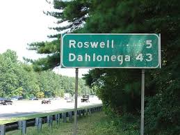
Now, North Fulton residents and government leaders are trying to recreate Milton County, which joined Fulton in 1931 - 32, along with Campbell County to save money. Roswell joined Fulton, ceding from Cobb, to make Fulton County a contiguous entity. This annexation gave Fulton a very irregular shape -- the county is 70 miles, "nose to tail." The two communities, North Fulton and South Fulton, are very, very different: North Fulton is very wealthy and mostly white; South Fulton is a low-income community that has gone through hard times and is mostly black. Because of this, many have accused the North Fulton residents of racism.
I don't think it's necessarily racism, but there are some racial over and undertones. I personally don't mind North Fulton splitting off from the rest of the county. I just don't like the fact that Atlanta and Fulton County's governments could merge, becoming Atlanta-Fulton County. This would mean every unincorporated area in the county would become apart of the City of Atlanta. The other cities in the county would still be independent, unless they de-incorporated and Atlanta annexed them. The City of Atlanta doesn't function well and neither does Fulton County; so this would be a big quagmire, to say the least.
This development will be very, very interesting to watch, whichever way it goes.
Fulton County to be Split Up
Milton County Debate Heats Up (WSB-TV)
Sunday, February 28, 2010
D'Iberville, Mississippi

I-10/110 Study (D'Iberville, MS)
D'Iberville, MS [HD] (Video)
Monday, February 15, 2010
Sugarloaf Parkway Extension
The parkway west of S.R. 20 is an at-grade, traffic light-ridden divided facility. The eastern portion will be six miles of limited-access roadway, once completed.
Sugarloaf Parkway Extension (video)
Sugarloaf Parkway Extension (project page)
Thursday, February 4, 2010
Left Lane-blocking Could be Costly
Recently, a Georgia legislator has come up with HB 1047, which would fine slow-driving lane left lane hogs up to $75 for this asinine driving habit. When I heard about this, all I could say was, "Yes!" The reason being is that it's annoying. It doesn't matter what the speed limit is -- the left lane is to be used for active passing. When you're finished passing, get out of the way, plain and simple.
Slow Drivers in the Left Lane Could be Fined
(Times-Herald.com)
Slow Drivers in the Left Lane Could be Fined
(Times-Herald.com)
Monday, January 18, 2010
Jefferson County, Alabama
Hey, y'all... this is Bryant again, with another blog post.
The video in this blog is of I-20/59 through Jefferson County, Alabama. The county seat of Jefferson County is Birmingham, which is the largest city in the State of Alabama, in terms of population, with a population of 229,800. Jefferson County is the most densely populated county in the state, boasting a population of 662,047.
Interstate 20 and 59 come together in eastern Birmingham, just west of Irondale. This interchange and the interchange of I-20/59 with I-65 are some of the most dangerous that I've driven through. It's good that I-459 was built, to cut down through traffic from having to utilize I-20/59 through Downtown Birmingham.
Jefferson County, Alabama [HD] (road video)
Jefferson County's official website
Birmingham's official website
Friday, January 8, 2010
Interstate 520
Hey y'all,
This is Bryant again, with another post and road video.
Interstate 520, known as the "Bobby Jones Expressway" in Augusta and the "Palmetto Parkway" in North Augusta, has been completed from exit 17 (U.S. 1/78/278) in North Augusta to its "parent" (I-20), just east of the Aiken-Richmond county line. With I-520 being completed, this gives thru traffic an alternative to I-20 through Augusta.
Additionally, I-520's America's only odd-numbered Interstate to end and begin at its "parent" route. Odd Interstate spur routes usually go off and don't come back into contact with their "parents." Example: I-85 and I-985 north of Atlanta. Even Interstates are usually loops/bypasses. Example: I-75 and I-475 near Macon, Georgia.
Interstate 520 (road video)
Palmetto Parkway (news video)
The Georgia Road Geek (I-520)
Subscribe to:
Posts (Atom)